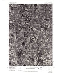
1976 Map of Stanley NW
USGS Topo · Published 1979About this map
The town of Stanley serves as the primary population center in this mid-1970s orthophotoquad, which provides a high-resolution aerial perspective of the Wisconsin landscape. The structured grid of the town site contrasts sharply with the winding course of the Wolf River, which snakes southward through a mix of dense woodlots and agricultural clearings. This photographic record, prepared from imagery captured by the U.S. Geological Survey in April 1976, reveals the intricate land-use patterns of the era, from the geometric precision of farm fields to the riparian corridors that define the drainage of the region. Researchers can observe the density of rural homesteads and the layout of the road network that connects the outlying areas to the centralized hub of Stanley.
Find a feature on this map
2 named features on this map. Tap any name to fly to it.
Don’t see what you’re looking for? This feature index may not catch every label — zoom into the map to look around manually.
Map Details
Editions of this 1976 Stanley NW Map
This is the sole edition of this map. No revisions or reprints were ever made.
Other maps of this area

1951 · Cornell
USGS Topo · 1:62,500

1951 · Gilman
USGS Topo · 1:62,500

1952 · Cadott
USGS Topo · 1:62,500

1952 · Stanley
USGS Topo · 1:62,500

1953 · Eau Claire
USGS Topo · 1:250,000

1953 · Rice Lake
USGS Topo · 1:250,000

1958 · Eau Claire
USGS Topo · 1:250,000

1959 · Rice Lake
USGS Topo · 1:250,000

1964 · Eau Claire
USGS Topo · 1:250,000
1973 · Colburn
USGS Topo · 1:24,000