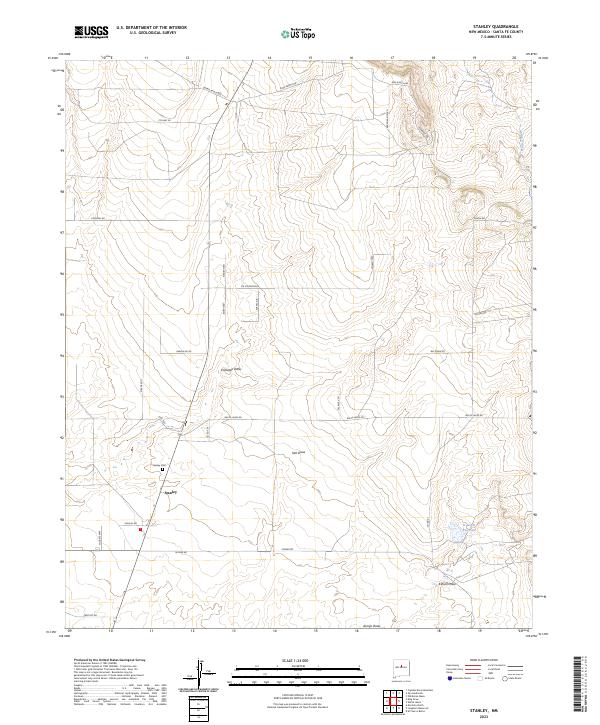
2023 Map of Stanley
USGS Topo · Published 2023About this map
Stanley serves as the primary focal point of this Santa Fe County landscape, where the high desert terrain is defined by an intricate network of named drainages and ranching corridors. The local geography is etched by watercourses such as Kamradt Draw, Salt Draw, and Kunsell Draw, which provide critical drainage through the township and range divisions. The small community presence is anchored by the Stanley Cem, a significant site for those researching local family histories in this part of New Mexico.
Find a feature on this map
39 named features on this map. Tap any name to fly to it.
Don’t see what you’re looking for? This feature index may not catch every label — zoom into the map to look around manually.
Map Details
Editions of this 2023 Stanley Map
This is the sole edition of this map. No revisions or reprints were ever made.
Other maps of this area

1892 · San Pedro
USGS Topo · 1:125,000

1894 · Lamy
USGS Topo · 1:125,000

1954 · Santa Fe
USGS Topo · 1:250,000

1956 · Edgewood
USGS Topo · 1:62,500

1958 · Santa Fe
USGS Topo · 1:250,000

1958 · Albuquerque
USGS Topo · 1:250,000

1960 · Stanley
USGS Topo · 1:62,500

1961 · Madrid
USGS Topo · 1:62,500

1962 · Albuquerque
USGS Topo · 1:250,000
1963 · Albuquerque
USGS Topo · 1:250,000