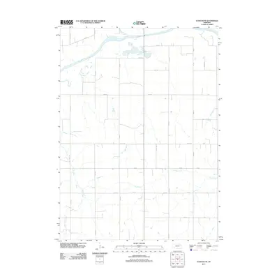
2011 Map of Stanton NE
USGS Topo · Published 2011About this map
The Elkhorn River meanders across the northern section of this Stanton County landscape, defining the local drainage patterns for numerous seasonal streams. This 2011 survey reveals a highly organized rural grid, where traditional section roads like 834 Rd and 573 Ave segment the agricultural plains. Significant water features such as Humbug Creek and Rock Creek intersect these gravel and dirt routes, providing a detailed look at the hydrology of the Nebraska prairie. For those tracing the evolution of regional transit, the path of Old Hwy 8 offers a clear contrast to modern thoroughfares like Hwy-15, which cuts North-South through the eastern townships. The map is a precise record of rural infrastructure, from the winding course of Cedar Creek to the various farm access points along Private Rd and 1st Rd.
Find a feature on this map
30 named features on this map. Tap any name to fly to it.
Don’t see what you’re looking for? This feature index may not catch every label — zoom into the map to look around manually.
Map Details
Editions of this 2011 Stanton NE Map
This is the sole edition of this map. No revisions or reprints were ever made.
Other maps of this area

1955 · Sioux City
USGS Topo · 1:250,000

1955 · Fremont
USGS Topo · 1:250,000

1957 · Fremont
USGS Topo · 1:250,000

1958 · Sioux City
USGS Topo · 1:250,000

1958 · Fremont
USGS Topo · 1:250,000

1959 · Sioux City
USGS Topo · 1:250,000

1963 · Pilger
USGS Topo · 1:24,000

1963 · Wayne SW
USGS Topo · 1:24,000

1963 · Wisner
USGS Topo · 1:24,000

1963 · Altona
USGS Topo · 1:24,000