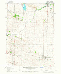
1965 Map of Stanwood
USGS Topo · Published 1966About this map
Muskrat Slough and its adjacent State Muskrat Slough Game Management Area define the northern lowlands of this Cedar County landscape, where the Rome township boundary meets Jones County. The mid-1960s terrain is heavily influenced by the drainage patterns of Walnut Creek, Pioneer Creek, and Rock Creek, which snake through the agricultural plateaus between established rail towns.
Find a feature on this map
22 named features on this map. Tap any name to fly to it.
Don’t see what you’re looking for? This feature index may not catch every label — zoom into the map to look around manually.
Map Details
Editions of this 1965 Stanwood Map
This is the sole edition of this map. No revisions or reprints were ever made.
Other maps of this area

1889 · Tipton
USGS Topo · 1:62,500

1890 · Tipton
USGS Topo · 1:62,500

1890 · Anamosa
USGS Topo · 1:62,500

1891 · Monticello
USGS Topo · 1:62,500

1891 · Mechanicsville
USGS Topo · 1:62,500

1894 · Mechanicsville
USGS Topo · 1:62,500

1900 · Anamosa
USGS Topo · 1:125,000

1901 · Stanwood
USGS Topo · 1:125,000
1953 · Tipton East
USGS Topo · 1:24,000

1958 · Davenport
USGS Topo · 1:250,000