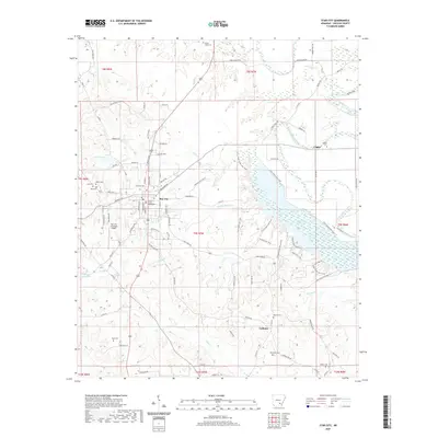
2020 Map of Star City
USGS Topo · Published 2020About this map
Star City serves as the focal point of this Lincoln County region, where the Lincoln County Courthouse marks the center of local government. The landscape is defined by the significant waters of Cane Creek Lake, which is surrounded by the extensive Cane Creek State Park. To the east, the winding course of Bayou Bartholomew snakes through the lowlands, creating a distinct natural boundary near the settlement of Crigler.
Find a feature on this map
104 named features on this map. Tap any name to fly to it.
Don’t see what you’re looking for? This feature index may not catch every label — zoom into the map to look around manually.
Map Details
Editions of this 2020 Star City Map
This is the sole edition of this map. No revisions or reprints were ever made.
Other maps of this area

1935 · Feenyville
USGS Topo · 1:62,500

1935 · Varner
USGS Topo · 1:62,500

1935 · Noble Lake
USGS Topo · 1:62,500

1935 · Rotan
USGS Topo · 1:62,500

1948 · Helena
USGS Topo · 1:250,000

1950 · Helena
USGS Topo · 1:250,000

1953 · Greenwood
USGS Topo · 1:250,000

1955 · Helena
USGS Topo · 1:250,000

1956 · Greenwood
USGS Topo · 1:250,000

1959 · Helena
USGS Topo · 1:250,000