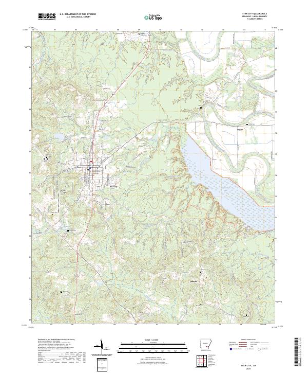
2024 Map of Star City
USGS Topo · Published 2024About this map
The Lincoln County Courthouse serves as the focal point for Star City, where the local road network radiates outward toward established rural communities like Crigler and Calhoun. This landscape is defined by the extensive waters of Cane Creek Lake, which occupies the eastern portion of the survey area, and the winding course of Bayou Bartholomew to the northeast. The distribution of family and community cemeteries, such as Mount Nebo Cem, Kirkwood Church Cem, and Brockman Cem, provides a significant genealogical footprint of the region's long-standing residents. Local infrastructure is anchored by the Star City Municipal Airport, while the surrounding terrain is deeply etched by a complex drainage system including Lick Creek, Ables Creek, and the Dry Fork Creek running through Panther Hollow.
Find a feature on this map
120 named features on this map. Tap any name to fly to it.
Don’t see what you’re looking for? This feature index may not catch every label — zoom into the map to look around manually.
Map Details
Editions of this 2024 Star City Map
This is the sole edition of this map. No revisions or reprints were ever made.
Other maps of this area

1935 · Feenyville
USGS Topo · 1:62,500

1935 · Varner
USGS Topo · 1:62,500

1935 · Noble Lake
USGS Topo · 1:62,500

1935 · Rotan
USGS Topo · 1:62,500

1948 · Helena
USGS Topo · 1:250,000

1950 · Helena
USGS Topo · 1:250,000

1953 · Greenwood
USGS Topo · 1:250,000

1955 · Helena
USGS Topo · 1:250,000

1956 · Greenwood
USGS Topo · 1:250,000

1959 · Helena
USGS Topo · 1:250,000