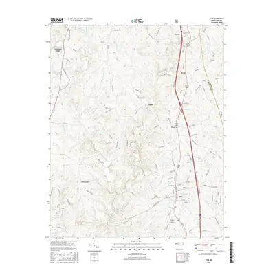
2016 Map of Star
USGS Topo · Published 2016About this map
Star and the eastern edge of Troy anchor this landscape where the Piedmont transition meets the Uwharrie National Forest. This 2016 survey documents a region defined by its timbered slopes and the complex drainage system of the Little River, which is fed by numerous tributaries like W Fork Little River, Suggs Cr, and Wolf Cr. The town of Star serves as a central hub, showing the intersection of local routes with the established rail line, while the Montgomery County Airport sits just south of the municipal boundary.
Find a feature on this map
119 named features on this map. Tap any name to fly to it.
Don’t see what you’re looking for? This feature index may not catch every label — zoom into the map to look around manually.
Map Details
Editions of this 2016 Star Map
This is the sole edition of this map. No revisions or reprints were ever made.
Other maps of this area

1942 · Troy
USGS Topo · 1:125,000

1953 · Raleigh
USGS Topo · 1:250,000

1954 · Raleigh
USGS Topo · 1:250,000

1957 · Troy
USGS Topo · 1:62,500

1957 · Asheboro
USGS Topo · 1:62,500

1968 · Erect
USGS Topo · 1:24,000
1973 · Eleazer
USGS Topo · 1:24,000

1973 · Seagrove
USGS Topo · 1:24,000

1974 · Candor
USGS Topo · 1:24,000
1977 · Spies
USGS Topo · 1:24,000