
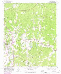
1974 Map of Candor
USGS Topo · Published 1977About this map
The Norfolk Southern railway forms the central spine of this mid-1970s landscape, connecting the town of Candor with the rural community of Eagle Springs. Spanning the border of Moore and Montgomery Counties, the area is defined by a mix of residential clusters and public institutions, notably the Samarcand Manor State Correctional Institution and the Uwharrie National Forest in the southwest. A legacy of local education and faith is visible through sites like Big Oak Academy and several country churches including Flint Hill Ch and Bensalem Ch. The terrain is deeply etched by a network of waterways including Drowning Creek, Wet Creek, and Cabin Creek, while the presence of numerous Sandpits points to the region's extraction activities during this era.
Find a feature on this map
30 named features on this map. Tap any name to fly to it.
Don’t see what you’re looking for? This feature index may not catch every label — zoom into the map to look around manually.
Map Details
Editions of this 1974 Candor Map
2 editions found
Other maps of this area

1942 · Troy
USGS Topo · 1:125,000

1949 · West End
USGS Topo · 1:24,000

1949 · Jackson Springs
USGS Topo · 1:62,500

1950 · Norman
USGS Topo · 1:24,000

1953 · Raleigh
USGS Topo · 1:250,000

1954 · Raleigh
USGS Topo · 1:250,000

1956 · Harrisville
USGS Topo · 1:24,000

1957 · Troy
USGS Topo · 1:62,500
1957 · Jackson Springs
USGS Topo · 1:62,500
1976 · West End
USGS Topo · 1:24,000