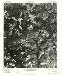
1976 Map of West End
USGS Topo · Published 1976About this map
West End and its surrounding rural landscapes are captured here during the mid-1970s, illustrating the distinct patterns of forestry and agricultural clearings in this part of Moore County. The orthophotoquad format provides an authentic look at the dense woodlands and the network of local roads connecting small communities like Roseland and Garren Hill. To the west, the settlement of Jackson Springs sits within a complex patchwork of orchards or timber tracts, while the meandering course of Drowning Creek marks the natural drainage of the region. Unlike traditional line maps, this photographic record reveals the exact footprint of farmsteads and individual structures, making it a valuable resource for understanding the land use and spatial development of these North Carolina communities before later 20th-century growth.
Find a feature on this map
5 named features on this map. Tap any name to fly to it.
Don’t see what you’re looking for? This feature index may not catch every label — zoom into the map to look around manually.
Map Details
Editions of this 1976 West End Map
This is the sole edition of this map. No revisions or reprints were ever made.
Other maps of this area

1942 · Troy
USGS Topo · 1:125,000

1948 · Southern Pines
USGS Topo · 1:62,500

1948 · Pinebluff
USGS Topo · 1:24,000

1949 · Millstone Lake
USGS Topo · 1:24,000

1949 · West End
USGS Topo · 1:24,000

1949 · Hoffman
USGS Topo · 1:24,000

1949 · Jackson Springs
USGS Topo · 1:62,500

1950 · Pine Bluff
USGS Topo · 1:24,000

1950 · Southern Pines
USGS Topo · 1:24,000

1950 · Norman
USGS Topo · 1:24,000