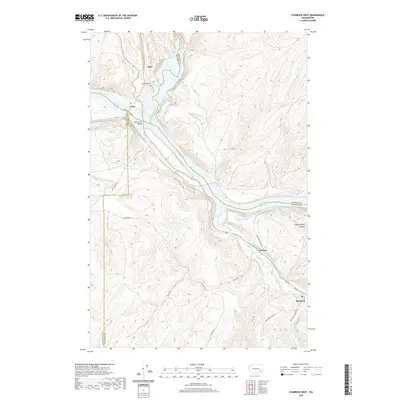
2020 Map of Starbuck West
USGS Topo · Published 2020About this map
The confluence of the Palouse River and Snake River anchors this study of the southeastern Washington landscape, where several county lines meet amidst complex riverine terrain. The town of Starbuck sits in the southeast corner near the Tucannon River, while the northern portion of the map is defined by the expansive Lake Herbert G West. This region serves as a significant transit corridor, evidenced by the Lyons Ferry Bridge and a network of rural routes including Lyons Ferry Rd and Powers Rd. Local history is preserved in small settlements and points of interest such as Joso, Perry, and Powers, along with the evocatively named Old Bones Cem. The topography transitions from the high ridges of Choke Cherry Canyon down to the river valleys, showing the intersection of Whitman and Columbia counties and their neighbors.
Find a feature on this map
29 named features on this map. Tap any name to fly to it.
Don’t see what you’re looking for? This feature index may not catch every label — zoom into the map to look around manually.
Map Details
Editions of this 2020 Starbuck West Map
This is the sole edition of this map. No revisions or reprints were ever made.
Other maps of this area

1919 · Walla Walla
USGS Topo · 1:125,000

1921 · Walla Walla
USGS Topo · 1:125,000

1948 · Starbuck
USGS Topo · 1:62,500

1948 · Ayer
USGS Topo · 1:62,500

1950 · Starbuck
USGS Topo · 1:62,500

1950 · Haas
USGS Topo · 1:62,500

1953 · Walla Walla
USGS Topo · 1:250,000

1958 · Walla Walla
USGS Topo · 1:250,000

1967 · Waitsburg NW
USGS Topo · 1:24,000
1967 · Kellogg Creek
USGS Topo · 1:24,000