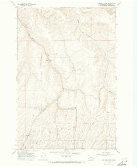
1967 Map of Kellogg Creek
USGS Topo · Published 1971About this map
Kellogg Creek carves a deep path through this Columbia County landscape, where the agricultural industry of the late 1960s is clearly defined by its transportation and storage infrastructure. The Union Pacific rail line runs through the southwest corner near Alto, while the remainder of the valley is traced by the Old Railroad Grade, showing the evolution of the region's transit network. These routes connect vital rural collection points such as Relief, characterized by a Grain Elevator and a Gravel Pit.
Find a feature on this map
16 named features on this map. Tap any name to fly to it.
Don’t see what you’re looking for? This feature index may not catch every label — zoom into the map to look around manually.
Map Details
Editions of this 1967 Kellogg Creek Map
This is the sole edition of this map. No revisions or reprints were ever made.
Other maps of this area

1919 · Walla Walla
USGS Topo · 1:125,000

1921 · Walla Walla
USGS Topo · 1:125,000

1937 · Pomeroy
USGS Topo · 1:96,000

1942 · Pomeroy
USGS Topo · 1:125,000

1948 · Starbuck
USGS Topo · 1:62,500

1950 · Starbuck
USGS Topo · 1:62,500

1950 · Hay
USGS Topo · 1:62,500

1952 · Hay
USGS Topo · 1:62,500

1953 · Walla Walla
USGS Topo · 1:250,000

1955 · Pullman
USGS Topo · 1:250,000