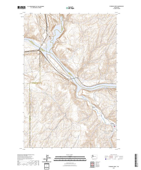
2023 Map of Starbuck West
USGS Topo · Published 2023About this map
The Snake River serves as the dominant geographical corridor through this corner of Washington, where the Palouse River and Tucannon River converge with the larger waterway. The settlement of Starbuck sits near the southeast corner of the map, anchored by Kellogg Creek and the Starbuck Cem. This region is a complex junction of multiple county lines, including Columbia, Walla Walla, Whitman, and Franklin, which meet along the riverbanks and ridges.
Find a feature on this map
29 named features on this map. Tap any name to fly to it.
Don’t see what you’re looking for? This feature index may not catch every label — zoom into the map to look around manually.
Map Details
Editions of this 2023 Starbuck West Map
This is the sole edition of this map. No revisions or reprints were ever made.
Other maps of this area

1919 · Walla Walla
USGS Topo · 1:125,000

1921 · Walla Walla
USGS Topo · 1:125,000

1948 · Starbuck
USGS Topo · 1:62,500

1948 · Ayer
USGS Topo · 1:62,500

1950 · Starbuck
USGS Topo · 1:62,500

1950 · Haas
USGS Topo · 1:62,500

1953 · Walla Walla
USGS Topo · 1:250,000

1958 · Walla Walla
USGS Topo · 1:250,000

1967 · Waitsburg NW
USGS Topo · 1:24,000
1967 · Kellogg Creek
USGS Topo · 1:24,000