
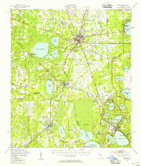
1949 Map of Starke
USGS Topo · Published 1955About this map
Starke serves as the focal point of this 1940s landscape, where the Seaboard Air Line and other rail corridors intersect to shape the region's development. The geography is defined by a dense network of water bodies, from the perfectly circular Kingsley Lake in the northeast to the sprawling Santa Fe Lake and Little Santa Fe Lake along the southern border. This period of transition is visible in the mix of established agricultural settlements and newer infrastructure, including the Keystone Airport and an Emergency Airfield near Lincoln City.
Find a feature on this map
69 named features on this map. Tap any name to fly to it.
Don’t see what you’re looking for? This feature index may not catch every label — zoom into the map to look around manually.
Map Details
Editions of this 1949 Starke Map
2 editions found
Other maps of this area

1890 · Arredondo
USGS Topo · 1:62,500

1892 · Arredondo
USGS Topo · 1:62,500

1894 · Arredondo
USGS Topo · 1:62,500

1915 · Interlachen
USGS Topo · 1:48,000

1916 · Interlachen
USGS Topo · 1:62,500

1918 · Middleburg
USGS Topo · 1:62,500

1918 · Lawtey
USGS Topo · 1:62,500

1938 · Hawthorn
USGS Topo · 1:48,000

1941 · Starke
USGS Topo · 1:62,500

1941 · Middleburg
USGS Topo · 1:62,500