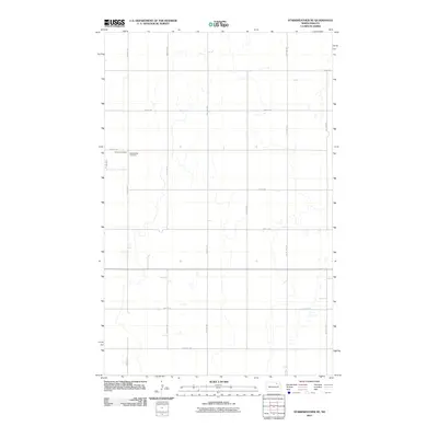
2011 Map of Starkweather NE
USGS Topo · Published 2011About this map
Starweather Cemetery and Calvary Cemetery sit along the western edge of this Ramsey County landscape, marking the enduring community ties of this North Dakota prairie. The terrain is defined by a strict section-line road grid, including 83rd Ave NE and 85th Ave NE, which intersect with east-west routes like 73rd St NE and 74th St NE. This geometry illustrates the late 19th-century homesteading patterns that divided the Great Plains into predictable blocks for agriculture. Countless small depressions and seasonal wetlands are scattered across the fields between 87th Ave NE and 88th Ave NE, revealing the glacial pothole geography typical of the region. This 2011 survey by the U.S. Geological Survey captures the area in its modern state, maintaining the same rural infrastructure established over a century prior.
Find a feature on this map
16 named features on this map. Tap any name to fly to it.
Don’t see what you’re looking for? This feature index may not catch every label — zoom into the map to look around manually.
Map Details
Editions of this 2011 Starkweather NE Map
This is the sole edition of this map. No revisions or reprints were ever made.
Other maps of this area

1953 · Devils Lake
USGS Topo · 1:250,000

1956 · Devils Lake
USGS Topo · 1:250,000

1957 · Starkweather SE
USGS Topo · 1:24,000

1957 · Webster
USGS Topo · 1:24,000

1962 · Starkweather
USGS Topo · 1:24,000

1962 · Starkweather NE
USGS Topo · 1:24,000

1970 · Hampden
USGS Topo · 1:24,000

1971 · Munich SW
USGS Topo · 1:24,000

1971 · Munich SE
USGS Topo · 1:24,000

1972 · Derrick NW
USGS Topo · 1:24,000