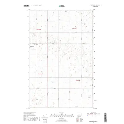
2017 Map of Starkweather NE
USGS Topo · Published 2017About this map
Starkweather serves as the primary hub for this section of Ramsey County, where the agricultural landscape is defined by the prairie potholes and drainage systems of the Red River Valley. The town site is closely flanked by two local burial grounds, Calvary Cem and the Starkweather Cem, providing a direct link to the community's early residents. To the southeast, the Sons of Jacob Cem stands as a significant landmark in the rural countryside, testifying to the diverse religious and ethnic heritage of the northern plains pioneers. The terrain is marked by seasonal water features like Shea Slough and the winding Starkweather Coulee, which dictate the placement of local infrastructure. A rigid grid of section-line roads, including CO Hwy 9 and several numbered streets, connects the scattered farmsteads across the townships of T158N and T157N.
Find a feature on this map
18 named features on this map. Tap any name to fly to it.
Don’t see what you’re looking for? This feature index may not catch every label — zoom into the map to look around manually.
Map Details
Editions of this 2017 Starkweather NE Map
This is the sole edition of this map. No revisions or reprints were ever made.
Other maps of this area

1953 · Devils Lake
USGS Topo · 1:250,000

1956 · Devils Lake
USGS Topo · 1:250,000

1957 · Starkweather SE
USGS Topo · 1:24,000

1957 · Webster
USGS Topo · 1:24,000

1962 · Starkweather
USGS Topo · 1:24,000

1962 · Starkweather NE
USGS Topo · 1:24,000

1970 · Hampden
USGS Topo · 1:24,000

1971 · Munich SW
USGS Topo · 1:24,000

1971 · Munich SE
USGS Topo · 1:24,000

1972 · Derrick NW
USGS Topo · 1:24,000