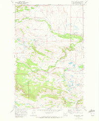
1968 Map of Starr School
USGS Topo · Published 1972About this map
The Blackfeet Indian Reservation landscape north of Browning is captured here during the late 1960s, a period when the irrigation network and ranching infrastructure were central to the local economy. The settlement of Starr School serves as a focal point, situated near the headwaters of the Greasewood Canal. Water management is a defining characteristic of this terrain, with the North Fork Cut Bank Creek and South Fork Cut Bank Creek carving through the plains.
Find a feature on this map
14 named features on this map. Tap any name to fly to it.
Don’t see what you’re looking for? This feature index may not catch every label — zoom into the map to look around manually.
Map Details
Editions of this 1968 Starr School Map
This is the sole edition of this map. No revisions or reprints were ever made.
Other maps of this area

1901 · Browning
USGS Topo · 1:125,000

1903 · Browning
USGS Topo · 1:125,000

1913 · Marias Pass
USGS Topo · 1:125,000

1960 · Cut Bank
USGS Topo · 1:250,000

1963 · Cut Bank
USGS Topo · 1:250,000

1964 · Cut Bank
USGS Topo · 1:250,000

1968 · Josephine
USGS Topo · 1:24,000
1968 · Kiowa
USGS Topo · 1:24,000

1968 · Browning NE
USGS Topo · 1:24,000
1968 · Browning
USGS Topo · 1:24,000