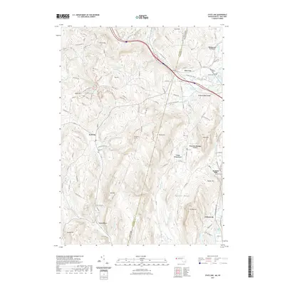
2021 Map of State Line
USGS Topo · Published 2021About this map
Richmond Furnace and the interstate hamlet of State Line anchor this study of the borderlands between Columbia County, New York, and Berkshire County, Massachusetts. The topography is defined by the steep rises of the Taconic Range, including Harvey Mtn and Tom Ball Mtn, which separate the drainage of Alford Brook from the Williams River valley. A history of industrial extraction is evident in names like Hudson Ore Bed Pond and Leet Ore Bed Pond, while the agricultural and manufacturing past is preserved at Rockdale Mills and Williamsville. The landscape is dotted with several significant burial grounds, including Saint Patricks Cem and the West Center Cem, providing key points of reference for genealogical research. Numerous recreational paths such as the Fire Tower Climb Trl and Bottoms Up Trl wind through the timbered slopes of Beebe Hill.
Find a feature on this map
116 named features on this map. Tap any name to fly to it.
Don’t see what you’re looking for? This feature index may not catch every label — zoom into the map to look around manually.
Map Details
Editions of this 2021 State Line Map
This is the sole edition of this map. No revisions or reprints were ever made.
Other maps of this area

1885 · Sheffield
USGS Topo · 1:62,500

1888 · Sheffield
USGS Topo · 1:62,500

1888 · Pittsfield
USGS Topo · 1:62,500

1890 · Pittsfield
USGS Topo · 1:62,500

1891 · Sheffield
USGS Topo · 1:62,500

1893 · Sheffield
USGS Topo · 1:62,500

1893 · Pittsfield
USGS Topo · 1:62,500

1894 · Pittsfield
USGS Topo · 1:62,500

1897 · Pittsfield
USGS Topo · 1:62,500

1897 · Sheffield
USGS Topo · 1:62,500