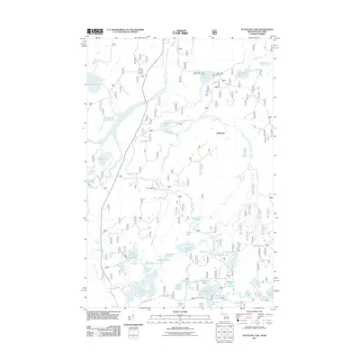
2011 Map of Stateline Lake
USGS Topo · Published 2011About this map
The Michigan-Wisconsin boundary divides this lake-strewn landscape, where the northern Highland State Forest and surrounding timberlands meet. The topography is defined by the complex hydrology of the Presque Isle River, including the West Branch Presque Isle River and the sprawling Presque Isle River Flooding. Small settlements such as Wellington and specialized sites like Camp Ojibway are linked by a network of forest service roads and county highways. The map reveals an intricate mosaic of glacial kettle lakes, ranging from larger bodies like Teal Lake and Stateline Lake to smaller, namesake waters like Chokecherry Lake and Pincherry Lake. Recreational infrastructure is evident at the Bobcat Lake Campground and Bobcat Lake Picnic Area, reflecting the area's transition into a destination for outdoorsmen and conservationists during the early 21st century.
Find a feature on this map
64 named features on this map. Tap any name to fly to it.
Don’t see what you’re looking for? This feature index may not catch every label — zoom into the map to look around manually.
Map Details
Editions of this 2011 Stateline Lake Map
This is the sole edition of this map. No revisions or reprints were ever made.
Other maps of this area

1939 · Trout Lake
USGS Topo · 1:48,000

1939 · Winchester
USGS Topo · 1:48,000

1946 · Winchester
USGS Topo · 1:48,000

1946 · Trout Lake
USGS Topo · 1:48,000

1949 · Trout Lake
USGS Topo · 1:48,000

1955 · Marenisco
USGS Topo · 1:62,500

1955 · Boulder Junction
USGS Topo · 1:62,500

1955 · Winchester
USGS Topo · 1:62,500

1955 · Marenisco
USGS Topo · 1:24,000

1955 · Wakefield
USGS Topo · 1:62,500