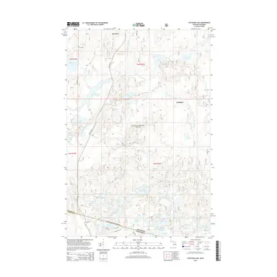
2014 Map of Stateline Lake
USGS Topo · Published 2014About this map
The Ottawa National Forest dominates this northern wilderness landscape, where the border between Michigan and Wisconsin is defined by dense woodlands and a complex network of glacial lakes. In the early 21st century, the area near Marenisco and Wellington shows a transition between forest service routes and state infrastructure, centered around the Presque Isle River Flooding. The river system is the primary geographic feature, with the South Branch Presque Isle River and the E Br Presque Isle River converging in a region punctuated by water bodies with distinctive names like Mastodon Lake, Jacksnipe Lake, and Meander Lake. Local transit is anchored by State Hwy 64 and Stateline Rd, which trace the heights between the varied wetlands and drainage basins of the Pelton River and local creeks.
Find a feature on this map
65 named features on this map. Tap any name to fly to it.
Don’t see what you’re looking for? This feature index may not catch every label — zoom into the map to look around manually.
Map Details
Editions of this 2014 Stateline Lake Map
This is the sole edition of this map. No revisions or reprints were ever made.
Other maps of this area

1939 · Trout Lake
USGS Topo · 1:48,000

1939 · Winchester
USGS Topo · 1:48,000

1946 · Winchester
USGS Topo · 1:48,000

1946 · Trout Lake
USGS Topo · 1:48,000

1949 · Trout Lake
USGS Topo · 1:48,000

1955 · Marenisco
USGS Topo · 1:62,500

1955 · Boulder Junction
USGS Topo · 1:62,500

1955 · Winchester
USGS Topo · 1:62,500

1955 · Marenisco
USGS Topo · 1:24,000

1955 · Wakefield
USGS Topo · 1:62,500