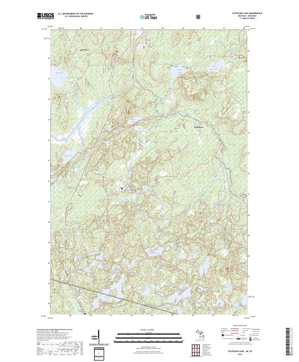
2023 Map of Stateline Lake
USGS Topo · Published 2023About this map
Stateline Lake straddles the border between Michigan and Wisconsin, serving as a primary landmark in this densely wooded region of the Ottawa National Forest. The landscape is defined by a high concentration of glacial lakes and wetlands, including Miller Lake, Teal Lake, and Meander Lake, which feed into the East Branch Presque Isle River. The settlement pattern is sparse, centered around the community of Marenisco in the north and the area of Wellington further south.
Find a feature on this map
63 named features on this map. Tap any name to fly to it.
Don’t see what you’re looking for? This feature index may not catch every label — zoom into the map to look around manually.
Map Details
Editions of this 2023 Stateline Lake Map
This is the sole edition of this map. No revisions or reprints were ever made.
Other maps of this area

1939 · Trout Lake
USGS Topo · 1:48,000

1939 · Winchester
USGS Topo · 1:48,000

1946 · Winchester
USGS Topo · 1:48,000

1946 · Trout Lake
USGS Topo · 1:48,000

1949 · Trout Lake
USGS Topo · 1:48,000

1955 · Marenisco
USGS Topo · 1:62,500

1955 · Boulder Junction
USGS Topo · 1:62,500

1955 · Winchester
USGS Topo · 1:62,500

1955 · Marenisco
USGS Topo · 1:24,000

1955 · Wakefield
USGS Topo · 1:62,500