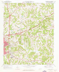
1969 Map of Statesville East
USGS Topo · Published 1973About this map
Statesville serves as the focal point of this late-1960s landscape, where the emerging path of Interstate 77 meets the established routes of the Southern railroad. The geography is defined by the eastward flow of Fifth Creek, Fourth Creek, and Third Creek, which carve a rolling terrain dotted with rural institutions. Researchers will find numerous community landmarks such as Bethany Ch, Oakwood Jr High Sch, and the State Correctional Center north of the city. To the east, the map captures the community of Elmwood and several family-named churches like Chestnut Grove Ch and Gays Chapel. This survey illustrates the transition of Iredell County as it modernized, balancing traditional agricultural spaces like the Williams Grove Ch area with new developments like the Statesville Country Club.
Find a feature on this map
64 named features on this map. Tap any name to fly to it.
Don’t see what you’re looking for? This feature index may not catch every label — zoom into the map to look around manually.
Map Details
Editions of this 1969 Statesville East Map
This is the sole edition of this map. No revisions or reprints were ever made.
Other maps of this area

1893 · Statesville
USGS Topo · 1:125,000

1953 · Charlotte
USGS Topo · 1:250,000

1954 · Charlotte
USGS Topo · 1:250,000

1960 · Charlotte
USGS Topo · 1:250,000

1962 · Charlotte
USGS Topo · 1:250,000

1969 · Cool Springs
USGS Topo · 1:24,000

1969 · Shepherds
USGS Topo · 1:24,000

1969 · Troutman
USGS Topo · 1:24,000
1969 · Harmony
USGS Topo · 1:24,000
1969 · Calahaln
USGS Topo · 1:24,000