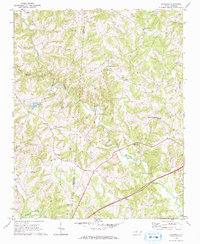
1969 Map of Calahaln
USGS Topo · Published 1972About this map
Hunting Creek meanders through the central hills of Davie and Iredell counties, anchoring a rural landscape defined by dispersed crossroads and community churches in the late 1960s. The area around Sheffield and Calahaln shows a dense network of country roads connecting established congregations such as Liberty Ch, New Union Ch, and Zion Chapel. This survey reflects the agricultural character of the North Carolina Piedmont before significant modern development, where small water bodies like Skyview Lake and Lake Myers dots the terrain. Genealogists will find interest in the numerous cemeteries and scattered settlements, including Ijames Crossroads and Society Ch, which mark the intersections of local life. The southern edge of the sheet is bounded by the Yadkin River, which receives the drainage of Dutchman Creek and Little Creek.
Find a feature on this map
28 named features on this map. Tap any name to fly to it.
Don’t see what you’re looking for? This feature index may not catch every label — zoom into the map to look around manually.
Map Details
Editions of this 1969 Calahaln Map
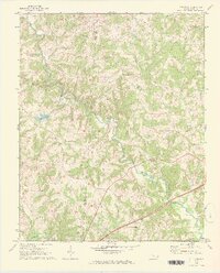
2 editions found
Other maps of this area

1891 · Yadkinville
USGS Topo · 1:125,000

1893 · Statesville
USGS Topo · 1:125,000

1893 · Yadkinville
USGS Topo · 1:125,000

1953 · Charlotte
USGS Topo · 1:250,000

1953 · Winston-Salem
USGS Topo · 1:250,000

1954 · Charlotte
USGS Topo · 1:250,000

1955 · Winston-Salem
USGS Topo · 1:250,000

1960 · Charlotte
USGS Topo · 1:250,000

1962 · Winston-Salem
USGS Topo · 1:250,000

1962 · Charlotte
USGS Topo · 1:250,000