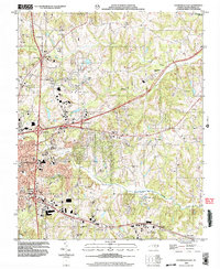
2002 Map of Statesville East
USGS Topo · Published 2005About this map
Statesville serves as the focal point of this Iredell County landscape, where the eastern corporate limits meet a network of rural communities and rolling creek basins. The area is defined by the convergence of major transit arteries, marked by Interchange 54 and Interchange 154, which cut through a terrain deeply rooted in local congregational history. A high density of rural houses of worship, including Bethany Ch, Gays Chapel, and Chestnut Grove Ch, illustrates the settlement patterns of the surrounding countryside.
Find a feature on this map
39 named features on this map. Tap any name to fly to it.
Don’t see what you’re looking for? This feature index may not catch every label — zoom into the map to look around manually.
Map Details
Editions of this 2002 Statesville East Map
This is the sole edition of this map. No revisions or reprints were ever made.
Other maps of this area

1893 · Statesville
USGS Topo · 1:125,000

1953 · Charlotte
USGS Topo · 1:250,000

1954 · Charlotte
USGS Topo · 1:250,000

1960 · Charlotte
USGS Topo · 1:250,000

1962 · Charlotte
USGS Topo · 1:250,000

1969 · Cool Springs
USGS Topo · 1:24,000

1969 · Shepherds
USGS Topo · 1:24,000

1969 · Troutman
USGS Topo · 1:24,000
1969 · Harmony
USGS Topo · 1:24,000
1969 · Calahaln
USGS Topo · 1:24,000