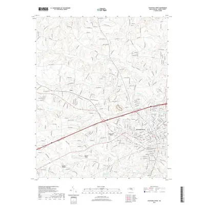
2019 Map of Statesville West
USGS Topo · Published 2019About this map
Statesville serves as the focal point of this North Carolina landscape, where the urban grid meets the agricultural fringes of Iredell County. The western reaches of the city are defined by established neighborhoods and industrial corridors, while the surrounding countryside is marked by a network of creek drainage systems including Fourth Cr, Third Cr, and Morrison Cr. This geographic layout highlights the transition from a traditional manufacturing and transportation hub to a modern regional center, anchored by the Statesville Regional Airport. Family-named roads such as Grier Farm Rd and Beatty Farm Ln crisscross the rural areas, hinting at a deep history of land ownership and farming. For researchers of local heritage, the inclusion of Oakwood Cem and Fourth Creek Cem offers specific locations for tracing genealogical roots within the community's oldest burial grounds.
Find a feature on this map
244 named features on this map. Tap any name to fly to it.
Don’t see what you’re looking for? This feature index may not catch every label — zoom into the map to look around manually.
Map Details
Editions of this 2019 Statesville West Map
This is the sole edition of this map. No revisions or reprints were ever made.
Other maps of this area

1893 · Statesville
USGS Topo · 1:125,000

1895 · Hickory
USGS Topo · 1:125,000

1953 · Charlotte
USGS Topo · 1:250,000

1954 · Charlotte
USGS Topo · 1:250,000

1960 · Charlotte
USGS Topo · 1:250,000

1962 · Charlotte
USGS Topo · 1:250,000

1969 · Shepherds
USGS Topo · 1:24,000

1969 · Troutman
USGS Topo · 1:24,000
1969 · Harmony
USGS Topo · 1:24,000

1969 · Statesville West
USGS Topo · 1:24,000