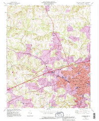
1993 Map of Statesville West
USGS Topo · Published 1996About this map
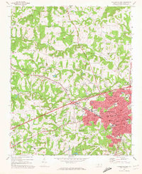
Statesville serves as the focal point of this Iredell County survey, showing a dense network of neighborhoods and civic institutions as they appeared in the 1990s. The city's educational and social infrastructure is well-defined, featuring Mitchell College and several specialized schools like Thompson Jr High Sch and Milla Sch. The spiritual landscape is exceptionally dense, ranging from the Gern Haywood Chapel to the The Bible Way Ch. To the west, the landscape transitions into rural communities such as Loray and Celeste Hinkel, where agricultural patterns are interspersed with small landmarks like the Midway Ch Cem. Waterways like Fourth Creek and Third Creek wind through the terrain, historically influencing the placement of settlements. The map also records significant infrastructure, including the Statesville Municipal Airport and the complex road systems defined by Western Ave and Virginia Ave.
Find a feature on this map
62 named features on this map. Tap any name to fly to it.
Don’t see what you’re looking for? This feature index may not catch every label — zoom into the map to look around manually.
Map Details
Editions of this 1993 Statesville West Map
This is the sole edition of this map. No revisions or reprints were ever made.
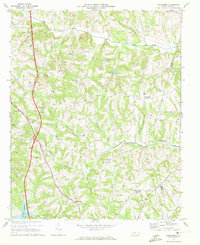
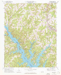
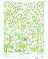
Other maps of this area

1893 · Statesville
USGS Topo · 1:125,000

1895 · Hickory
USGS Topo · 1:125,000

1953 · Charlotte
USGS Topo · 1:250,000

1954 · Charlotte
USGS Topo · 1:250,000

1960 · Charlotte
USGS Topo · 1:250,000

1962 · Charlotte
USGS Topo · 1:250,000
1969 · Shepherds
USGS Topo · 1:24,000
1969 · Troutman
USGS Topo · 1:24,000
1969 · Harmony
USGS Topo · 1:24,000
1969 · Statesville West
USGS Topo · 1:24,000