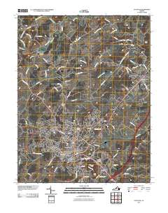
2010 Map of Staunton
USGS Topo · Published 2010About this map
Staunton and its northern outskirts are mapped here in the early twenty-first century, revealing a landscape where modern development meets deep-rooted local heritage. The city’s historic core is flanked by significant sites such as the expansive Thornrose Cemetery, the Staunton National Cemetery, and the Western State Hospital. Outside the urban center, the terrain is shaped by the winding Middle River and its many tributaries, including Moffett Creek and Poague Run. This map documents a series of smaller communities and historic mill sites that dot the countryside, such as Franks Mill and Quicks Mill. The prominent heights of Betsey Bell and Mary Gray stand south of the city, providing a natural southern boundary to the valley floor's settlement patterns. Residential neighborhoods like Selma, Skymont, and Woodlee reflect the late-century growth patterns extending from the original city limits toward Verona.
Find a feature on this map
89 named features on this map. Tap any name to fly to it.
Don’t see what you’re looking for? This feature index may not catch every label — zoom into the map to look around manually.
Map Details
Editions of this 2010 Staunton Map
This is the sole edition of this map. No revisions or reprints were ever made.
Other maps of this area

1892 · Harrisonburg
USGS Topo · 1:125,000

1894 · Staunton
USGS Topo · 1:125,000

1934 · Waynesboro
USGS Topo · 1:48,000

1939 · Waynesboro
USGS Topo · 1:62,500

1941 · Harrisonburg
USGS Topo · 1:62,500

1943 · Harrisonburg
USGS Topo · 1:62,500

1944 · Parnassus
USGS Topo · 1:62,500

1944 · Staunton
USGS Topo · 1:62,500

1947 · Staunton
USGS Topo · 1:62,500

1947 · Parnassus
USGS Topo · 1:62,500