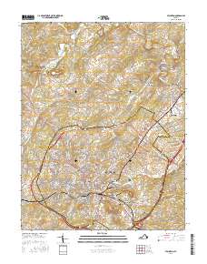
2016 Map of Staunton
USGS Topo · Published 2016About this map
Staunton and its surrounding hill country are captured in this mid-2010s survey, highlighting the intersection of historical education and institutional land use in Augusta County. The city core is anchored by the Mary Baldwin Coll campus and the sprawling grounds of Thornrose Cem, while the industrial past of the valley is reflected in milling sites like Franks Mill and Quicks Mill along the Middle River. Neighborhoods and smaller communities such as Selma, Plunkettsville, and Dogwood Hill fill the gaps between the rolling terrain of Betsey Bell and Mary Gray. The map reveals a landscape heavily shaped by local watercourses, including Poague Run and Lewis Cr, which have historically dictated the placement of roads and settlements throughout the quadrangle. Genealogists and historians will find significant detail in the various burial grounds, from the Western State Hospital Cem to the modern Oak Lawn Mausoleum and Memory Gardens.
Find a feature on this map
204 named features on this map. Tap any name to fly to it.
Don’t see what you’re looking for? This feature index may not catch every label — zoom into the map to look around manually.
Map Details
Editions of this 2016 Staunton Map
This is the sole edition of this map. No revisions or reprints were ever made.
Other maps of this area

1892 · Harrisonburg
USGS Topo · 1:125,000

1894 · Staunton
USGS Topo · 1:125,000

1934 · Waynesboro
USGS Topo · 1:48,000

1939 · Waynesboro
USGS Topo · 1:62,500

1941 · Harrisonburg
USGS Topo · 1:62,500

1943 · Harrisonburg
USGS Topo · 1:62,500

1944 · Parnassus
USGS Topo · 1:62,500

1944 · Staunton
USGS Topo · 1:62,500

1947 · Staunton
USGS Topo · 1:62,500

1947 · Parnassus
USGS Topo · 1:62,500