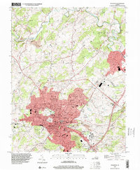
1998 Map of Staunton
USGS Topo · Published 2001About this map
Staunton and its northern outskirts in Augusta County are shown here as the city evolved in the late 20th century. The landscape is defined by the winding course of the Middle River and several prominent institutions that shaped the local identity, including the State School for Deaf and Blind and Mary Baldwin College. The urban core is surrounded by historic neighborhoods like Selma and West End, while industrial and logistical hubs such as Verona expand to the northeast along the CSX Transportation rail corridor.
Find a feature on this map
68 named features on this map. Tap any name to fly to it.
Don’t see what you’re looking for? This feature index may not catch every label — zoom into the map to look around manually.
Map Details
Editions of this 1998 Staunton Map
This is the sole edition of this map. No revisions or reprints were ever made.
Other maps of this area

1892 · Harrisonburg
USGS Topo · 1:125,000

1894 · Staunton
USGS Topo · 1:125,000

1934 · Waynesboro
USGS Topo · 1:48,000

1939 · Waynesboro
USGS Topo · 1:62,500

1941 · Harrisonburg
USGS Topo · 1:62,500

1943 · Harrisonburg
USGS Topo · 1:62,500

1944 · Parnassus
USGS Topo · 1:62,500

1944 · Staunton
USGS Topo · 1:62,500

1947 · Staunton
USGS Topo · 1:62,500

1947 · Parnassus
USGS Topo · 1:62,500