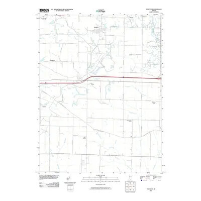
2010 Map of Staunton
USGS Topo · Published 2010About this map
Staunton and Seelyville anchor this 2010 study of the landscape east of Terre Haute, where the topography is defined by numerous small waterways and scattered rural settlements. The map documents several prairie-named regions such as Wheeler Prairie and Clay Prairie, reflecting the historical transition of the land. Genealogists will find significant value in the distribution of burial grounds across the township, including German Cemetery, Rhule Cemetery, and Summit Lawn Cemetery.
Find a feature on this map
60 named features on this map. Tap any name to fly to it.
Don’t see what you’re looking for? This feature index may not catch every label — zoom into the map to look around manually.
Map Details
Editions of this 2010 Staunton Map
This is the sole edition of this map. No revisions or reprints were ever made.
Other maps of this area

1908 · Clay City
USGS Topo · 1:48,000

1910 · Clay City
USGS Topo · 1:62,500

1940 · Lewis
USGS Topo · 1:24,000

1941 · Seelyville
USGS Topo · 1:24,000

1950 · Rosedale
USGS Topo · 1:24,000

1950 · Brazil East
USGS Topo · 1:24,000

1950 · Brazil West
USGS Topo · 1:24,000
1952 · Lewis
USGS Topo · 1:24,000

1952 · Seelyville
USGS Topo · 1:24,000

1953 · Indianapolis
USGS Topo · 1:250,000