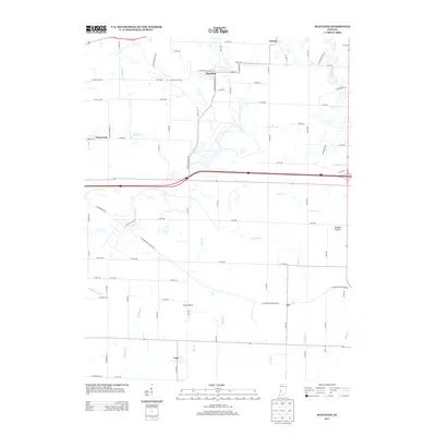
2013 Map of Staunton
USGS Topo · Published 2013About this map
Staunton and Cory serve as the primary anchors of this southwestern Indiana landscape in the early 21st century. The terrain is defined by its wide, level stretches including Clay Prairie and Wheeler Prairie, where agricultural land use is intersected by a complex drainage network. Watercourses such as Honey Cr, Little Birch Cr, and Crooked Cr wind through the township sections, while the distinctive Stone Quarry Br and Big Slough mark the lower elevations.
Find a feature on this map
60 named features on this map. Tap any name to fly to it.
Don’t see what you’re looking for? This feature index may not catch every label — zoom into the map to look around manually.
Map Details
Editions of this 2013 Staunton Map
This is the sole edition of this map. No revisions or reprints were ever made.
Other maps of this area

1908 · Clay City
USGS Topo · 1:48,000

1910 · Clay City
USGS Topo · 1:62,500

1940 · Lewis
USGS Topo · 1:24,000

1941 · Seelyville
USGS Topo · 1:24,000

1950 · Rosedale
USGS Topo · 1:24,000

1950 · Brazil East
USGS Topo · 1:24,000

1950 · Brazil West
USGS Topo · 1:24,000
1952 · Lewis
USGS Topo · 1:24,000

1952 · Seelyville
USGS Topo · 1:24,000

1953 · Indianapolis
USGS Topo · 1:250,000