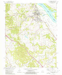
1979 Map of Ste. Genevieve
USGS Topo · Published 1980About this map
Ste Genevieve anchors this Missouri riverfront landscape during a period of transition in the late 1970s. The town's historical positioning on the Mississippi River is contrasted with the industrial activity of the interior, where the Mississippi Mine and Peerless Mine are located near the village of Mosher. To the south, the settlement of New Bourbon and the industrial outpost of Quarry Town reflect the region's long-standing connection to resource extraction and river trade.
Find a feature on this map
45 named features on this map. Tap any name to fly to it.
Don’t see what you’re looking for? This feature index may not catch every label — zoom into the map to look around manually.
Map Details
Editions of this 1979 Ste. Genevieve Map
This is the sole edition of this map. No revisions or reprints were ever made.
Other maps of this area

1907 · Weingarten
USGS Topo · 1:62,500

1909 · Weingarten
USGS Topo · 1:62,500

1912 · Baldwin
USGS Topo · 1:62,500

1914 · Baldwin
USGS Topo · 1:62,500

1915 · Renault
USGS Topo · 1:62,500

1915 · Chester
USGS Topo · 1:62,500

1940 · Renault
USGS Topo · 1:62,500

1942 · Baldwin
USGS Topo · 1:62,500

1947 · Chester
USGS Topo · 1:62,500

1949 · Saint Louis
USGS Topo · 1:250,000