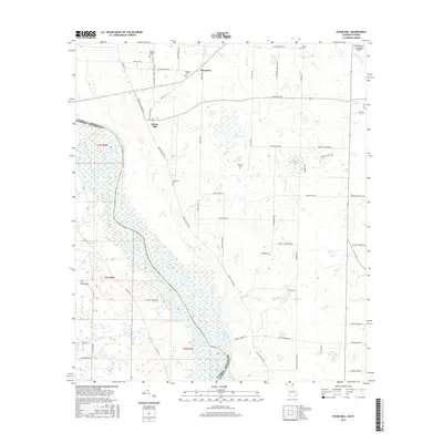
2017 Map of Steam Mill
USGS Topo · Published 2017About this map
The Chattahoochee River forms the winding border between Seminole County, Georgia, and Jackson County, Florida, where it broadens into the northern reaches of Lake Seminole. This 2017 survey reveals a rural landscape defined by agricultural road networks and the wet, low-lying terrain of The Hammocks and The Flatwoods. Settlement centers like Steam Mill and Riverturn are small, largely composed of scattered homesteads connected by routes such as Ned Alday River Rd and Hebrew Hwy.
Find a feature on this map
62 named features on this map. Tap any name to fly to it.
Don’t see what you’re looking for? This feature index may not catch every label — zoom into the map to look around manually.
Map Details
Editions of this 2017 Steam Mill Map
This is the sole edition of this map. No revisions or reprints were ever made.
Other maps of this area

1952 · Dellwood
USGS Topo · 1:24,000

1952 · Bascom
USGS Topo · 1:24,000

1953 · Dothan
USGS Topo · 1:250,000

1954 · Dothan
USGS Topo · 1:250,000

1954 · Steam Mill
USGS Topo · 1:24,000

1954 · Desser
USGS Topo · 1:24,000

1954 · Tallahassee
USGS Topo · 1:250,000

1955 · Dothan
USGS Topo · 1:250,000

1955 · Fairchild
USGS Topo · 1:24,000

1955 · Reynoldsville
USGS Topo · 1:24,000