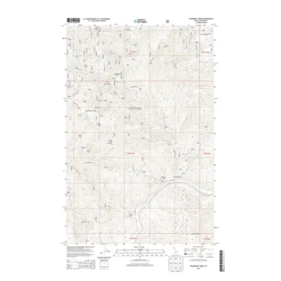
2014 Map of Steamboat Creek
USGS Topo · Published 2014About this map
The Coeur d'Alene National Forest defines the character of this Idaho terrain, where the North Fork Coeur d'Alene River winds through a landscape of deep gulches and steep ridges. Higher elevations are marked by distinctive landmarks such as Cougar Peak Lookout and Steamboat Peak, while the valley floor below follows the path of Old River Rd near the riverbank. This area, largely managed for timber and conservation, shows a complex network of drainages including Steamboat Cr, Omaha Cr, and November Cr. The interior remains largely undeveloped, centered around the Steamboat Camp site. Named features like Steamboat Rock and the Black Canyon indicate the dramatic geology that has historically influenced travel and resource management in Shoshone County.
Find a feature on this map
53 named features on this map. Tap any name to fly to it.
Don’t see what you’re looking for? This feature index may not catch every label — zoom into the map to look around manually.
Map Details
Editions of this 2014 Steamboat Creek Map
This is the sole edition of this map. No revisions or reprints were ever made.
Other maps of this area

1901 · Coeur D'Alene District
USGS Topo · 1:62,500

1903 · Coeur D'Alene District
USGS Topo · 1:62,500

1906 · Coeur D'Alene District
USGS Topo · 1:62,500

1909 · Cataldo
USGS Topo · 1:125,000

1911 · Cataldo
USGS Topo · 1:125,000

1955 · Spokane
USGS Topo · 1:250,000

1957 · Kingston
USGS Topo · 1:62,500

1957 · Kellogg
USGS Topo · 1:62,500

1958 · Spokane
USGS Topo · 1:250,000

1961 · Lakeview
USGS Topo · 1:62,500