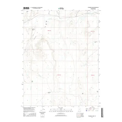
2017 Map of Steamboat Point
USGS Topo · Published 2017About this map
Blue Valley and its surrounding desert terrain are the focal points of this 2017 survey of Wayne County. The Fremont River winds across the northern sections of the map, providing a vital water source in a landscape otherwise defined by arid features like Town Wash and Sand Wash. For genealogists and local historians, the inclusion of Giles Cem and the Blue Valley Cemetery provides specific locations for ancestral research within this corner of Utah. The topography is dominated by prominent elevations such as Steamboat Point and the Pinto Hills. A network of unpaved roads, including N Blue Valley Rd E and Giles Rd, provides the primary access to the isolated cattle-grazing lands of the Blue Valley Benches and the scattered water sources like Bert Avery Seep.
Find a feature on this map
28 named features on this map. Tap any name to fly to it.
Don’t see what you’re looking for? This feature index may not catch every label — zoom into the map to look around manually.
Map Details
Editions of this 2017 Steamboat Point Map
This is the sole edition of this map. No revisions or reprints were ever made.
Other maps of this area

1885 · San Rafael
USGS Topo · 1:250,000

1952 · Mt. Ellen 4 NW
USGS Topo · 1:24,000

1952 · Bull Mountain
USGS Topo · 1:62,500

1954 · Mt. Ellen 2 SE
USGS Topo · 1:24,000

1954 · Mt. Ellen 2 SW
USGS Topo · 1:24,000

1954 · Mt. Ellen 1 NW
USGS Topo · 1:24,000

1954 · Mt. Ellen 2 NE
USGS Topo · 1:24,000

1954 · Mt. Ellen 2 NW
USGS Topo · 1:24,000

1954 · Mt. Ellen 1 SW
USGS Topo · 1:24,000

1954 · Factory Butte
USGS Topo · 1:62,500