
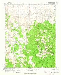
1952 Map of Mt. Ellen 4 NW
USGS Topo · Published 1954About this map
Fairview Ranch and the Granite Ranch (Site) anchor this mid-century preliminary survey of the remote canyonlands where the Wayne Co Garfield Co line bisects the high desert. The landscape is dominated by the massive profile of Bull Mountain and the surrounding drainage systems of Granite Creek and Halfway Wash. This 1952 study captures a period of sparse land use, characterized by isolated ranching outposts and infrastructure like the East Gate Reservoir and a Water Well in the northern reach.
Find a feature on this map
18 named features on this map. Tap any name to fly to it.
Don’t see what you’re looking for? This feature index may not catch every label — zoom into the map to look around manually.
Map Details
Editions of this 1952 Mt. Ellen 4 NW Map
This is the sole edition of this map. No revisions or reprints were ever made.
Other maps of this area

1885 · San Rafael
USGS Topo · 1:250,000

1952 · Mount Ellen 4 SW
USGS Topo · 1:24,000

1952 · Bull Mountain
USGS Topo · 1:62,500

1954 · Mt. Ellen 2 SE
USGS Topo · 1:24,000

1954 · Mt. Ellen 1 SW
USGS Topo · 1:24,000

1954 · Factory Butte
USGS Topo · 1:62,500

1956 · Salina
USGS Topo · 1:250,000

1960 · Salina
USGS Topo · 1:250,000

1962 · Salina
USGS Topo · 1:250,000
1962 · Mt. Ellen
USGS Topo · 1:62,500