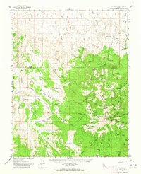
1962 Map of Mt. Ellen
USGS Topo · Published 1964About this map
Mt Ellen Peak dominates this high-elevation desert landscape, serving as the centerpiece for a network of complex drainage systems and ridges. The 1962 terrain reveals a region defined by isolation and resource extraction, specifically at the Bromide Mine and the Kimble and Turner Mine near Kimble and Turner Peak. These industrial sites are tucked into the high basins of the Henry Mountains, connected by a web of primitive trails and jeep tracks that traverse the dramatic shifts in elevation.
Find a feature on this map
107 named features on this map. Tap any name to fly to it.
Don’t see what you’re looking for? This feature index may not catch every label — zoom into the map to look around manually.
Map Details
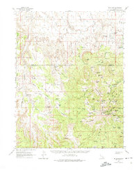
Editions of this 1962 Mt. Ellen Map
2 editions found
Other maps of this area

1885 · San Rafael
USGS Topo · 1:250,000

1885 · Fish Lake
USGS Topo · 1:250,000

1886 · Escalante
USGS Topo · 1:250,000

1886 · Henry Mountains
USGS Topo · 1:250,000

1892 · Henry Mountains
USGS Topo · 1:250,000

1896 · Fish Lake
USGS Topo · 1:250,000

1952 · Notom 4 SE
USGS Topo · 1:24,000

1952 · Mount Ellen 4 SW
USGS Topo · 1:24,000

1952 · Mt Pennell 2 NE
USGS Topo · 1:24,000

1952 · Notom 4 NE
USGS Topo · 1:24,000