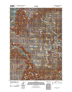
2011 Map of Stearns Butte
USGS Topo · Published 2011About this map
Crooked River carves a deep path through this Central Oregon landscape, anchoring a terrain defined by dramatic basalt formations and canyon systems. The volcanic prominence of Stearns Butte overlooks the northern portion of the map, where the Stearns Ranch represents the region's agricultural heritage. This era shows a mix of traditional ranching and modern recreation, evidenced by the development of the Dry Creek Airpark and the Chimney Rock Campground along the riverbank. Water management is central to the area's utility, with features like Hoffman Dam and the Dry Creek Number Two Reservoir capturing the seasonal flow of Dry Creek. The map documents a rugged geology where Swartz Canyon, Rocky Canyon, and Devils Canyon converge near the river's winding course.
Find a feature on this map
96 named features on this map. Tap any name to fly to it.
Don’t see what you’re looking for? This feature index may not catch every label — zoom into the map to look around manually.
Map Details
Editions of this 2011 Stearns Butte Map
This is the sole edition of this map. No revisions or reprints were ever made.
Other maps of this area

1946 · Eagle Rock
USGS Topo · 1:62,500

1948 · Eagle Rock
USGS Topo · 1:62,500

1948 · Ochoco Reservoir
USGS Topo · 1:62,500

1950 · Ochoco Reservoir
USGS Topo · 1:62,500

1955 · Bend
USGS Topo · 1:250,000

1957 · Bend
USGS Topo · 1:250,000

1958 · Bend
USGS Topo · 1:250,000

1962 · Huston Lake
USGS Topo · 1:24,000

1962 · Prineville
USGS Topo · 1:24,000

1962 · Powell Buttes
USGS Topo · 1:62,500