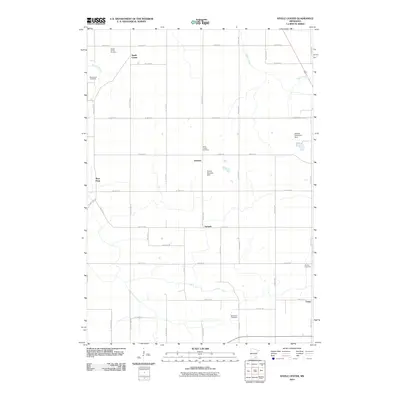
2010 Map of Steele Center
USGS Topo · Published 2010About this map
Steele Center serves as a central landmark in this agricultural landscape of Steele County, Minnesota, during the first decade of the 21st century. The map reveals a tapestry of small rural communities and ethnic heritage markers, notably the Bohemian Cemetery and Danish Cemetery, which reflect the early settlement patterns of the region. Waterways like the Straight River and Turtle Creek dictate the local topography, complemented by man-made infrastructure such as the Donald Anderson Dam. A rigid grid of township roads, including S County HWY-45 and County HWY-3, connects these scattered settlements. The presence of tiny locales like Litomysl, Summit, and Union illustrates the persistent structure of Minnesota's rural townships, while cemeteries such as Holy Trinity Cemetery and Oak Mound Cemetery provide specific geographic points of interest for genealogical research into the families who cultivated these lands.
Find a feature on this map
44 named features on this map. Tap any name to fly to it.
Don’t see what you’re looking for? This feature index may not catch every label — zoom into the map to look around manually.
Map Details
Editions of this 2010 Steele Center Map
This is the sole edition of this map. No revisions or reprints were ever made.
Other maps of this area

1953 · Saint Paul
USGS Topo · 1:250,000

1954 · Mason City
USGS Topo · 1:250,000

1957 · Mason City
USGS Topo · 1:250,000

1958 · Mason City
USGS Topo · 1:250,000

1959 · Saint Paul
USGS Topo · 1:250,000

1962 · Owatonna
USGS Topo · 1:24,000

1962 · Owatonna SE
USGS Topo · 1:24,000

1962 · Saco
USGS Topo · 1:24,000

1967 · Steele Center
USGS Topo · 1:24,000

1967 · Bixby
USGS Topo · 1:24,000