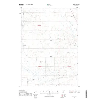
2019 Map of Steele Center
USGS Topo · Published 2019About this map
The agricultural landscape of central Steele County is defined by a dense grid of section roads and the winding path of the Straight River along its western edge. Small rural hubs such as Steele Center, Litomysl, and Summit serve as historical anchors for the surrounding farmsteads. The cultural heritage of the area is particularly evident in its numerous cemeteries, which reflect the diverse immigrant groups that settled the region, including the Bohemian Cem and Danish Cem. These sites, along with Holy Trinity Cem and Oak Mound Cem, provide essential landmarks for genealogical research. To the north, Turtle Cr drains through the rolling fields toward Union, illustrating the localized drainage patterns that shaped early land use before modern development. The map meticulously documents the transition from township-based rural life to a more connected contemporary infrastructure.
Find a feature on this map
36 named features on this map. Tap any name to fly to it.
Don’t see what you’re looking for? This feature index may not catch every label — zoom into the map to look around manually.
Map Details
Editions of this 2019 Steele Center Map
This is the sole edition of this map. No revisions or reprints were ever made.
Other maps of this area

1953 · Saint Paul
USGS Topo · 1:250,000

1954 · Mason City
USGS Topo · 1:250,000

1957 · Mason City
USGS Topo · 1:250,000

1958 · Mason City
USGS Topo · 1:250,000

1959 · Saint Paul
USGS Topo · 1:250,000

1962 · Owatonna
USGS Topo · 1:24,000

1962 · Owatonna SE
USGS Topo · 1:24,000

1962 · Saco
USGS Topo · 1:24,000

1967 · Steele Center
USGS Topo · 1:24,000

1967 · Bixby
USGS Topo · 1:24,000