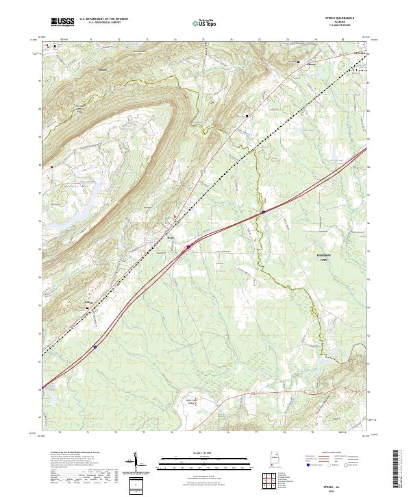
2024 Map of Steele
USGS Topo · Published 2024About this map
The Canoe Creek Valley defines the landscape of this region where the Etowah Co St Clair Co line cuts through the foothills. The settlement of Steele serves as a central hub along the Norfolk Southern rail line, surrounded by family-named landmarks and rural outposts. To the northwest, the elevated terrain of Chandler Mtn is home to the Chandler Natural Bridge, while the valleys below are marked by historical gathering places like Deerman Chapel Cem and Shiloh Cem. This 2024 data reveals a community still rooted in its geography, with many legacy names preserved across the hills. Traces of early settlement persist in small communities such as Gallant and Gilbert, situated near the headwaters of Gulf Creek and Clear Creek, illustrating the enduring relationship between the area's residents and its drainage systems.
Find a feature on this map
99 named features on this map. Tap any name to fly to it.
Don’t see what you’re looking for? This feature index may not catch every label — zoom into the map to look around manually.
Map Details
Editions of this 2024 Steele Map
This is the sole edition of this map. No revisions or reprints were ever made.
Historical Maps of Ramsey Through Time
4 maps found