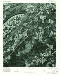
1975 Map of Steele
USGS Topo · Published 1977About this map
Steele and Gallant occupy a landscape where the tight ridges of northeast Alabama meet expanding modern infrastructure. This 1975 orthophotoquad, produced by the U.S. Geological Survey in cooperation with the Soil Conservation Service, reveals a distinct contrast between the heavily forested mountainous terrain and the cleared, fertile valley floors. The image captures the impact of the Interstate highway system as it cuts across the rural landscape, redirecting the flow of travel and commerce away from older local routes. By utilizing actual aerial imagery from December 1975, the map provides an unvarnished view of land use patterns, showing exactly how timber tracts, small-scale agriculture, and residential clusters were distributed shortly after the mid-century.
Find a feature on this map
2 named features on this map. Tap any name to fly to it.
Don’t see what you’re looking for? This feature index may not catch every label — zoom into the map to look around manually.
Map Details
Editions of this 1975 Steele Map
This is the sole edition of this map. No revisions or reprints were ever made.
Other maps of this area

1885 · Gadsden
USGS Topo · 1:125,000

1888 · Gadsden
USGS Topo · 1:125,000

1889 · Springville
USGS Topo · 1:125,000

1892 · Springville
USGS Topo · 1:125,000

1892 · Gadsden
USGS Topo · 1:125,000

1895 · Gadsden
USGS Topo · 1:125,000

1903 · Gadsden
USGS Topo · 1:125,000

1947 · Cox Gap
USGS Topo · 1:24,000

1947 · Dunaway Mountain
USGS Topo · 1:24,000

1947 · Steele
USGS Topo · 1:24,000