
1947 Map of Steele
USGS Topo · Published 1953About this map
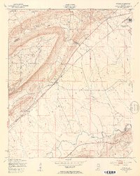
Camp Sibert occupies the northeastern corner of this landscape, a significant military footprint marked as abandoned just after the war. The map reveals the specialized infrastructure of the installation, including a Firing Range and a Tank, situated near the community of Lester. To the southwest, the terrain transitions into the Canoe Creek Valley, where the town of Steele serves as a primary settlement along the Southern railroad line. The geographic divide between Etowah Co and St Clair Co runs diagonally through the center, cutting across the ridges and valleys. Local life is anchored by rural landmarks such as Shiloh Ch, Deerman Chapel, and Hopewell Ch, which are scattered among the drainages of Big Canoe Creek and Little Canoe Creek. A long Pipe Line cuts a straight path across the valley floor, highlighting mid-century industrial utility alongside traditional rail-oriented settlements like Gilbert and Gallant.
Find a feature on this map
20 named features on this map. Tap any name to fly to it.
Don’t see what you’re looking for? This feature index may not catch every label — zoom into the map to look around manually.
Map Details
Editions of this 1947 Steele Map
3 editions found
Other maps of this area

1885 · Gadsden
USGS Topo · 1:125,000

1888 · Gadsden
USGS Topo · 1:125,000

1889 · Springville
USGS Topo · 1:125,000

1892 · Springville
USGS Topo · 1:125,000

1892 · Gadsden
USGS Topo · 1:125,000

1895 · Gadsden
USGS Topo · 1:125,000

1903 · Gadsden
USGS Topo · 1:125,000

1947 · Cox Gap
USGS Topo · 1:24,000

1947 · Dunaway Mountain
USGS Topo · 1:24,000

1947 · Steele
USGS Topo · 1:62,500