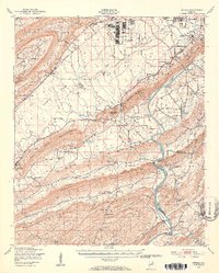
1947 Map of Steele
USGS Topo · Published 1953About this map
Camp Sibert occupies a significant footprint in this post-war landscape, situated north of the Gadsden Municipal Airport. The mapping reveals a rural Alabama river economy in transition, where the Coosa River remains a central artery even as older crossings like Listers Ferry and McCardney Ferry are noted as out of use. The topography is dominated by the parallel ridges of the Beaver Creek Mountains and Shinbone Ridge, creating long, narrow valleys that channeled early settlement and transportation.
Find a feature on this map
78 named features on this map. Tap any name to fly to it.
Don’t see what you’re looking for? This feature index may not catch every label — zoom into the map to look around manually.
Map Details
Editions of this 1947 Steele Map
2 editions found

Other maps of this area

1885 · Gadsden
USGS Topo · 1:125,000

1888 · Gadsden
USGS Topo · 1:125,000

1889 · Springville
USGS Topo · 1:125,000

1892 · Springville
USGS Topo · 1:125,000

1892 · Gadsden
USGS Topo · 1:125,000

1893 · Fort Payne
USGS Topo · 1:125,000

1895 · Gadsden
USGS Topo · 1:125,000

1898 · Fort Payne
USGS Topo · 1:125,000

1900 · Fort Payne
USGS Topo · 1:125,000

1900 · Anniston
USGS Topo · 1:125,000