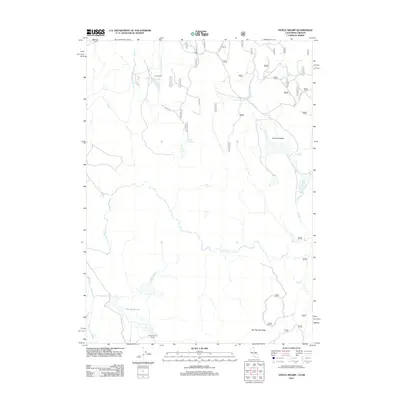
2012 Map of Steele Swamp
USGS Topo · Published 2012About this map
Steele Swamp and its namesake Steele Swamp Ranch anchor this landscape along the border of Oregon and California. The 2012 topography shows a remote high-desert terrain defined by vital water sources and early ranching foundations. Isolated outposts like Grohs Ranch are connected by a network of forest roads, including Dog Lake Rd and Kellogg Rd, which trace the drainage patterns of Willow Cr and Rock Cr. To the north, Fort Spring and Warm Spring emerge from the arid slopes of Bird Spring Ridge, suggesting the importance of these seasonal and permanent water points to the local livestock industry. The presence of the Fourmile Reservoir within the wide expanse of Fourmile Valley further illustrates the managed hydrology of the region, where every creek and reservoir serves the vast open ranges of Klamath County.
Find a feature on this map
35 named features on this map. Tap any name to fly to it.
Don’t see what you’re looking for? This feature index may not catch every label — zoom into the map to look around manually.
Map Details
Editions of this 2012 Steele Swamp Map
This is the sole edition of this map. No revisions or reprints were ever made.
Other maps of this area

1886 · Alturas
USGS Topo · 1:250,000

1886 · Modoc Lava Bed
USGS Topo · 1:250,000

1889 · Klamath
USGS Topo · 1:250,000

1892 · Modoc Lava-Bed
USGS Topo · 1:250,000

1892 · Alturas
USGS Topo · 1:250,000

1894 · Klamath
USGS Topo · 1:250,000

1951 · Clear Lake Reservoir
USGS Topo · 1:62,500

1954 · Alturas
USGS Topo · 1:250,000

1955 · Klamath Falls
USGS Topo · 1:250,000

1958 · Alturas
USGS Topo · 1:250,000