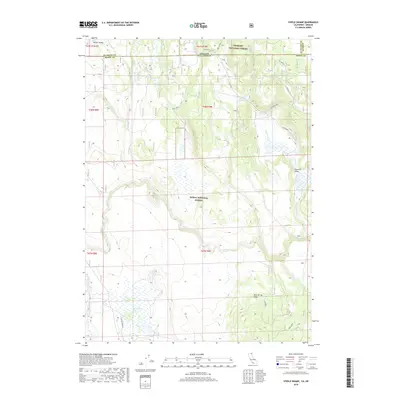
2018 Map of Steele Swamp
USGS Topo · Published 2018About this map
Steele Swamp and the high desert wetlands of the Oregon-California border define this 2018 survey. The landscape is a complex intersection of public lands, split between the Fremont National Forest to the north and the Modoc National Forest to the south. This area is characterized by seasonal water sources and volcanic topography, featuring vital riparian points like Fort Spring, Warm Spring, and the Fourmile Reservoir. Traces of the frontier era remain visible through the Old State Line and early routes like Willow Valley Rd. The terrain is marked by significant geological rises, including Four Mile Rim and Bird Spring Ridge, which overlook the drainages of Fourmile Cr and Willow Cr. This map provides a clear record of the jurisdictional boundaries and natural water features critical to this remote ranching and timber region.
Find a feature on this map
33 named features on this map. Tap any name to fly to it.
Don’t see what you’re looking for? This feature index may not catch every label — zoom into the map to look around manually.
Map Details
Editions of this 2018 Steele Swamp Map
This is the sole edition of this map. No revisions or reprints were ever made.
Other maps of this area

1886 · Alturas
USGS Topo · 1:250,000

1886 · Modoc Lava Bed
USGS Topo · 1:250,000

1889 · Klamath
USGS Topo · 1:250,000

1892 · Modoc Lava-Bed
USGS Topo · 1:250,000

1892 · Alturas
USGS Topo · 1:250,000

1894 · Klamath
USGS Topo · 1:250,000

1951 · Clear Lake Reservoir
USGS Topo · 1:62,500

1954 · Alturas
USGS Topo · 1:250,000

1955 · Klamath Falls
USGS Topo · 1:250,000

1958 · Alturas
USGS Topo · 1:250,000