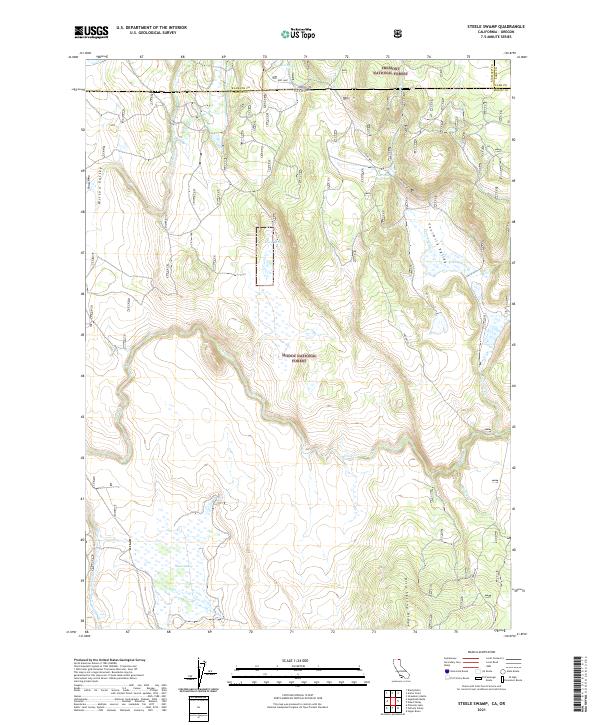
2021 Map of Steele Swamp
USGS Topo · Published 2021About this map
The California-Oregon border cuts across this high-desert landscape where the Fremont National Forest meets the Modoc National Forest. The map is centered on a series of basins and drainages, most notably Steele Swamp and the high-altitude Dog Lake. This area was historically traversed by the Old State Line road, which skirts the northern edge of Fourmile Valley. The terrain is defined by volcanic features and hydrologic markers like Bird Spring Ridge and Fourmile Reservoir. Water sources are critical in this environment, with Fort Spring and Warm Spring providing reliable points of reference for land management and early travelers between Klamath and Modoc counties. The detailed mapping of Willow Cr and Rock Creek illustrates the complex drainage patterns feeding into the larger swamp systems.
Find a feature on this map
19 named features on this map. Tap any name to fly to it.
Don’t see what you’re looking for? This feature index may not catch every label — zoom into the map to look around manually.
Map Details
Editions of this 2021 Steele Swamp Map
This is the sole edition of this map. No revisions or reprints were ever made.
Other maps of this area

1886 · Alturas
USGS Topo · 1:250,000

1886 · Modoc Lava Bed
USGS Topo · 1:250,000

1889 · Klamath
USGS Topo · 1:250,000

1892 · Modoc Lava-Bed
USGS Topo · 1:250,000

1892 · Alturas
USGS Topo · 1:250,000

1894 · Klamath
USGS Topo · 1:250,000

1951 · Clear Lake Reservoir
USGS Topo · 1:62,500

1954 · Alturas
USGS Topo · 1:250,000

1955 · Klamath Falls
USGS Topo · 1:250,000

1958 · Alturas
USGS Topo · 1:250,000