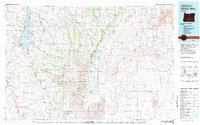
1982 Map of Steens Mtn
USGS Topo · Published 1983About this map
Steens Mountain dominates this high-desert landscape in Harney and Malheur Counties, rising dramatically above the Alvord Desert and Coyote Lake to the east. The 1982 survey depicts a vast network of water resources and drainage patterns essential to this arid region, including the Malheur National Wildlife Refuge and the headwaters of the Blitzen River. The isolated settlement of Frenchglen serves as a lone hub near the Jackass Mountains, while the rugged Catlow Rim defines the western edge of the quadrangle.
Find a feature on this map
46 named features on this map. Tap any name to fly to it.
Don’t see what you’re looking for? This feature index may not catch every label — zoom into the map to look around manually.
Map Details
Editions of this 1982 Steens Mtn Map
2 editions found
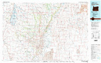
Other maps of this area

1955 · Jordan Valley
USGS Topo · 1:250,000

1955 · Burns
USGS Topo · 1:250,000

1955 · Adel
USGS Topo · 1:250,000

1955 · Boise
USGS Topo · 1:250,000

1957 · Adel
USGS Topo · 1:250,000

1957 · Jordan Valley
USGS Topo · 1:250,000

1958 · Burns
USGS Topo · 1:250,000

1958 · Boise
USGS Topo · 1:250,000

1958 · Adel
USGS Topo · 1:250,000

1958 · Jordan Valley
USGS Topo · 1:250,000