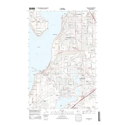
2014 Map of Steilacoom
USGS Topo · Published 2014About this map
Steilacoom and its historic waterfront anchor this 2014 survey, illustrating a landscape defined by the deep waters of the Puget Sound and a dense network of freshwater basins. The map captures the specialized transportation links of the South Sound, specifically the Steilacoom - Anderson Ferry and Steilacoom - Ketron Ferry routes departing from the Steilacoom Ferry Landing. Inward from the coast, the terrain is characterized by large glacial lakes, including Gravelly Lake, Steilacoom Lake, and American Lake, which are surrounded by established residential communities like Lakewood and University Place. The presence of North Fort Lewis at the southern margin and institutional hubs such as Pierce Coll at Ft-Steilacoom reflects the area's dual role as a military and educational center. Notable local landmarks like Ponders Corner and Titlow provide specific points of reference for genealogists tracing 21st-century suburban development patterns.
Find a feature on this map
79 named features on this map. Tap any name to fly to it.
Don’t see what you’re looking for? This feature index may not catch every label — zoom into the map to look around manually.
Map Details
Editions of this 2014 Steilacoom Map
This is the sole edition of this map. No revisions or reprints were ever made.
Other maps of this area

1897 · Tacoma
USGS Topo · 1:125,000

1900 · Tacoma
USGS Topo · 1:125,000

1940 · Anderson Island
USGS Topo · 1:62,500

1941 · Tacoma South
USGS Topo · 1:62,500

1942 · Gig Harbor
USGS Topo · 1:62,500

1943 · Gig Harbor
USGS Topo · 1:62,500

1944 · Tacoma South
USGS Topo · 1:62,500

1948 · Anderson Island
USGS Topo · 1:62,500

1948 · Fort Lewis
USGS Topo · 1:24,000

1948 · Nisqually
USGS Topo · 1:24,000