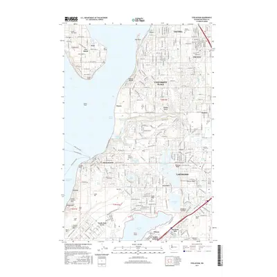
2017 Map of Steilacoom
USGS Topo · Published 2017About this map
Steilacoom serves as a central anchor on this coastal survey, where the historic town's street grid meets the waters of Puget Sound and several ferry routes, including the McNeil Island Ferry and Ketron Island Ferry. The landscape is a mix of dense residential developments like University Place and Lakewood, and large-scale military installations at Fort Lewis and McChord AFB. The geography is defined by its diverse water bodies, from the vast American Lake and Steilacoom Lake to the protected waters of Chambers Bay. Notable landmarks for local history include several significant burial grounds such as New Tacoma Cem and Home of Peace Cem. The inclusion of Fox Island and the smaller Ketron island highlights the maritime connectivity of this Pierce County region.
Find a feature on this map
65 named features on this map. Tap any name to fly to it.
Don’t see what you’re looking for? This feature index may not catch every label — zoom into the map to look around manually.
Map Details
Editions of this 2017 Steilacoom Map
This is the sole edition of this map. No revisions or reprints were ever made.
Other maps of this area

1897 · Tacoma
USGS Topo · 1:125,000

1900 · Tacoma
USGS Topo · 1:125,000

1940 · Anderson Island
USGS Topo · 1:62,500

1941 · Tacoma South
USGS Topo · 1:62,500

1942 · Gig Harbor
USGS Topo · 1:62,500

1943 · Gig Harbor
USGS Topo · 1:62,500

1944 · Tacoma South
USGS Topo · 1:62,500

1948 · Anderson Island
USGS Topo · 1:62,500

1948 · Fort Lewis
USGS Topo · 1:24,000

1948 · Nisqually
USGS Topo · 1:24,000