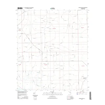
2015 Map of Steinhatchee SE
USGS Topo · Published 2015About this map
Horseshoe and the surrounding coastal marshlands of Dixie County characterize this 2015 survey of the Florida Gulf Coast. The landscape is defined by its low-lying hydrology, where Rocky Cr and Little Rocky Cr drain through a network of rectangular section lines. These watercourses flow toward the Gulf, carving through an area marked by a dense grid of rural roads such as SW 457th Ave and SW 461st Ave. For genealogists and local historians, the presence of the Butler Cem provides a specific point of interest for family research within this rural setting. The survey reflects a sparsely populated area where the economy and settlement patterns are dictated by the swampy terrain and the proximity to the coast, with the majority of the map surface dedicated to undeveloped land and simple transit routes.
Find a feature on this map
143 named features on this map. Tap any name to fly to it.
Don’t see what you’re looking for? This feature index may not catch every label — zoom into the map to look around manually.
Map Details
Editions of this 2015 Steinhatchee SE Map
This is the sole edition of this map. No revisions or reprints were ever made.
Other maps of this area

1954 · Steinhatchee SW
USGS Topo · 1:24,000

1954 · Cross City West
USGS Topo · 1:24,000

1954 · Jena
USGS Topo · 1:24,000

1954 · Steinhatchee
USGS Topo · 1:24,000

1954 · Steinhatchee SE
USGS Topo · 1:24,000

1954 · Cross City SW
USGS Topo · 1:24,000

1954 · Horseshoe Beach
USGS Topo · 1:24,000

1954 · Gainesville
USGS Topo · 1:250,000

1955 · Shired Island
USGS Topo · 1:24,000

1958 · Gainesville
USGS Topo · 1:250,000